Blue Light,
Black Spot
EV infrastructure gaps, broadband failures, and operational geography intersecting to create risk for Welsh blue light fleets. 1,792,247 postcodes analysed across 40 variables.
Where the infrastructure gap becomes a blue light problem
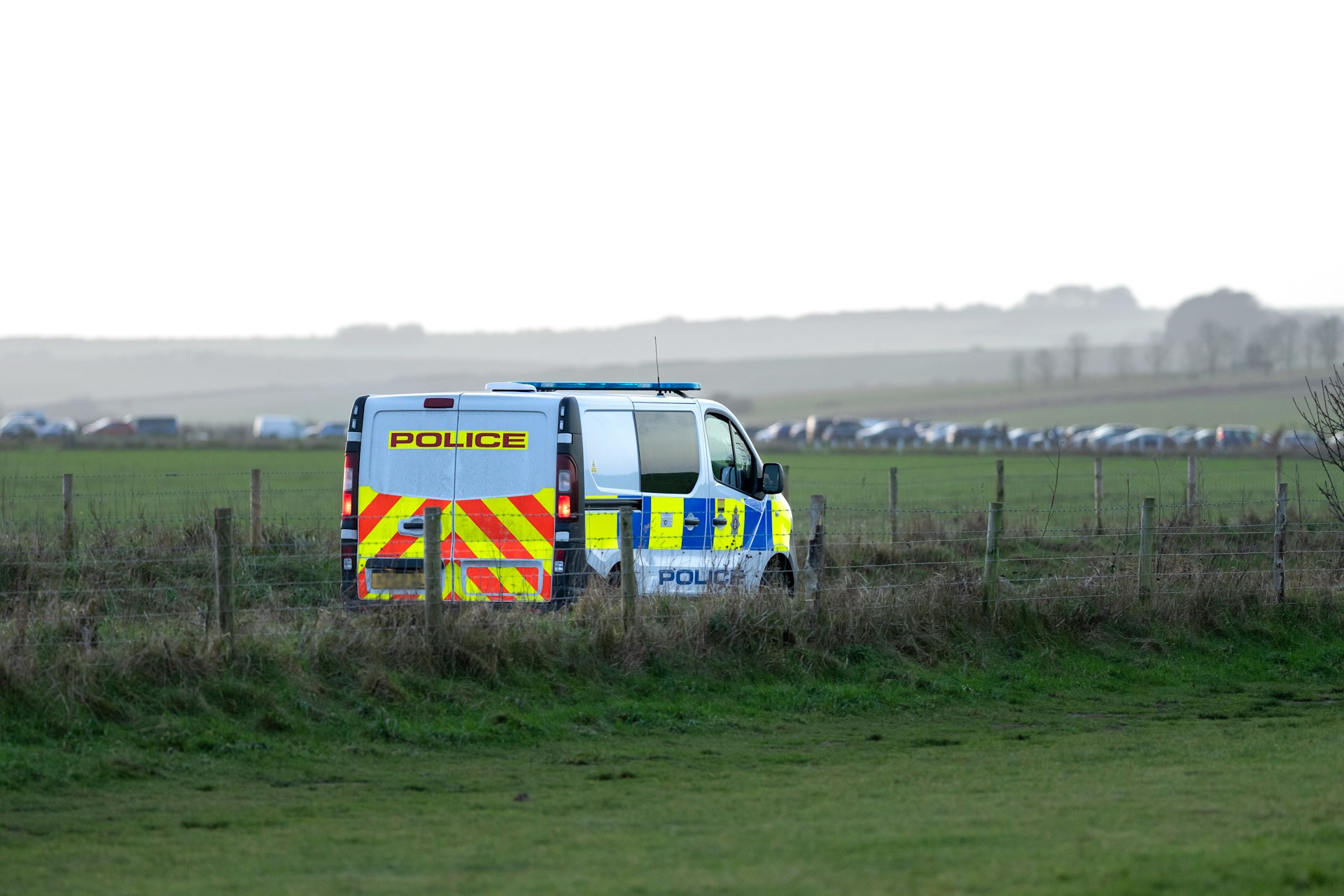
Wales is electrifying its blue light fleets under Welsh Government net zero commitments. But across mid and west Wales, the charging infrastructure is not ready for what is being asked of it. This report maps where EV charging gaps, broadband failures, and emergency service operational geography converge.
The most isolated charging blackspot in Wales. The worst-case postcode is 25.3 miles from the nearest Major A&E. Gigabit broadband availability is zero. Most postcodes sit in IMD decile one. A Welsh Ambulance Service vehicle operating from Cardigan must charge at Carmarthen or Haverfordwest before or after a shift.
The highest average distance to a rapid charger of any Welsh local authority at 5.8 miles across 3,082 postcodes. Also the highest average distance to a fire station at 3.4 miles and a hospital at 7.2 miles. The three worst infrastructure figures in Wales converge in the same county.
The largest county in Wales by area averages 5.5 miles to the nearest rapid charger across 6,117 postcodes, with fewer than one rapid charger within 5 miles on average. Welsh Ambulance Service rural response already involves the longest patient transport distances in Wales. Adding charging logistics compounds an already stretched operation.
Despite being a geographically bounded island with a single main road corridor, Anglesey averages 12.0 miles to the nearest police station — the worst figure in Wales. With 1.27 rapids within 5 miles on average, a North Wales Police vehicle operating an electric vehicle on Anglesey faces both charging constraints and the longest response distances to backup.
4.06 percent of premises cannot receive 2Mbit/s broadband, the worst figure in Wales, and a direct threat to the connectivity modern chargepoints require for payment processing and remote monitoring. A chargepoint without adequate broadband is operationally compromised from the moment it is installed.
The nearest fire station to the worst-case SA43 postcodes is Crymych at 9.8 miles, a retained on-call station where crew must travel to the station before any vehicle moves. An electric fire engine returning low on charge to Crymych has no local recovery option. The infrastructure gap is geographic and it is measurable.
SA43: Where every metric fails at once
No other postcode area in Wales presents the same combination of charging gap, hospital distance, broadband failure, and deprivation. The data is verified against NHS facility data, Welsh Government fire station records, and Ofcom residential coverage files.
| Postcode | Nearest Major A&E | A&E dist | Nearest Rapid | Nearest Fire Station | Gigabit | IMD Decile |
|---|---|---|---|---|---|---|
| SA43 1PU | Withybush, Haverfordwest | 25.3mi | 19.9mi | Crymych 9.8mi | 0% | 1 |
| SA43 1QA | Withybush, Haverfordwest | 25.0mi | 19.9mi | Crymych 9.4mi | 0% | 1 |
| SA43 1PZ | Withybush, Haverfordwest | 24.9mi | 19.9mi | Crymych 9.3mi | 0% | 1 |
| SA43 1PX | Withybush, Haverfordwest | 24.8mi | 19.8mi | Crymych 9.3mi | 0% | 1 |
| SA43 1PS | Withybush, Haverfordwest | 24.7mi | 19.8mi | Crymych 9.2mi | 0% | 1 |
| SA43 2QT | Glangwili, Carmarthen | 18.1mi | 20.2mi | Cardigan 4.8mi | 0% | 2 |
| SA43 2QU | Glangwili, Carmarthen | 18.0mi | 20.1mi | Cardigan 4.8mi | 0% | 2 |
| SA43 2QW | Glangwili, Carmarthen | 18.3mi | 20.4mi | Cardigan 5.0mi | 0% | 1 |
| SA43 1JX | Glangwili, Carmarthen | 20.0mi | 20.1mi | Crymych 7.1mi | 0% | 5 |
| SA43 1PA | Glangwili, Carmarthen | 19.8mi | 19.9mi | Crymych 7.8mi | 0% | 1 |
Three forces, one corridor, no infrastructure
Ceredigion, Powys, and Carmarthenshire form a contiguous corridor across mid and west Wales where EV charging infrastructure, broadband connectivity, and emergency service access are simultaneously at their weakest. This is not coincidence. It reflects decades of underinvestment that now creates compounding risk as fleet electrification accelerates.
The force areas most exposed are Dyfed-Powys Police and Welsh Ambulance Service NHS Trust. Dyfed-Powys covers the four local authorities with the highest average distances to rapid chargers in Wales. Mid and West Wales Fire and Rescue Service covers 4,500 square miles — the largest fire service area in England and Wales — with the majority of its 58 stations crewed by retained on-call firefighters.
Wales does not have access to the Local Electric Vehicle Infrastructure fund, which is an England-only programme. EV charging is funded through the Regional Transport Grant and must compete within a broader envelope. In 2026 to 2027, the entire South East Wales region received just £50,000 for ULEV activity.
Ceredigion has the highest average distance to a rapid charger, the highest average distance to a hospital, and the highest average distance to a fire station of any Welsh local authority. Three compounding failures in the same county.
Avg distance to nearest rapid charger by LA
Wales by local authority
All 22 Welsh local authorities across charging infrastructure, broadband connectivity, hospital distance, fire station distance, police station distance, and deprivation. Sorted by average distance to nearest rapid charger.
| LA | Avg Nearest Rapid | Rapids within 5mi | Gigabit % | No 2Mbit/s % | Avg Hospital | Avg Fire Stn | Avg Police | IMD |
|---|---|---|---|---|---|---|---|---|
| Ceredigion | 5.8mi | 1.11 | 49.8% | 3.27% | 7.2mi | 3.4mi | 5.0mi | 5.8 |
| Powys | 5.5mi | 0.65 | 54.2% | 3.65% | 5.0mi | 2.9mi | 6.4mi | 6.5 |
| Gwynedd | 4.2mi | 0.78 | 60.0% | 1.39% | 4.4mi | 2.5mi | 4.9mi | 6.1 |
| Carmarthenshire | 4.0mi | 1.17 | 54.2% | 4.06% | 4.3mi | 2.7mi | 5.6mi | 5.3 |
| Pembrokeshire | 3.6mi | 1.75 | 57.9% | 1.93% | 6.3mi | 2.7mi | 5.1mi | 5.9 |
| Conwy | 3.4mi | 0.78 | 77.9% | 1.45% | 2.9mi | 1.7mi | 4.0mi | 6.0 |
| Rhondda Cynon Taf | 3.3mi | 0.82 | 74.2% | 0.06% | 2.0mi | 1.4mi | 2.0mi | 4.6 |
| Isle of Anglesey | 3.0mi | 1.27 | 56.3% | 1.29% | 4.4mi | 2.3mi | 12.0mi | 5.9 |
| Bridgend | 2.9mi | 1.78 | 84.7% | 0.26% | 1.8mi | 1.2mi | 2.3mi | 5.5 |
| Monmouthshire | 2.6mi | 1.64 | 66.2% | 1.32% | 3.3mi | 2.1mi | 1.8mi | 7.2 |
| Neath Port Talbot | 2.6mi | 1.35 | 77.8% | 0.08% | 2.1mi | 1.5mi | 2.9mi | 4.2 |
| Caerphilly | 2.4mi | 1.62 | 83.3% | 0.16% | 2.8mi | 1.5mi | 1.3mi | 4.9 |
| Denbighshire | 2.4mi | 2.54 | 77.1% | 1.16% | 2.5mi | 1.5mi | 2.0mi | 5.6 |
| Torfaen | 2.4mi | 2.51 | 78.0% | 0.23% | 1.8mi | 0.9mi | 1.3mi | 4.8 |
| Blaenau Gwent | 2.0mi | 1.26 | 66.9% | 0.11% | 1.3mi | 1.0mi | 1.0mi | 3.3 |
| Flintshire | 1.9mi | 2.09 | 88.2% | 0.40% | 2.3mi | 1.8mi | 3.6mi | 6.7 |
| Merthyr Tydfil | 1.9mi | 1.76 | 73.1% | 0.08% | 1.9mi | 1.2mi | 1.1mi | 3.8 |
| Wrexham | 1.9mi | 3.57 | 72.6% | 0.36% | 2.0mi | 2.5mi | 2.1mi | 6.1 |
| Swansea | 1.6mi | 3.60 | 85.3% | 0.37% | 1.6mi | 1.5mi | 1.5mi | 5.9 |
| Cardiff | 0.9mi | 10.27 | 92.5% | 0.05% | 1.1mi | 1.3mi | 1.1mi | 5.8 |
| Newport | 0.8mi | 10.23 | 91.4% | 0.01% | 1.3mi | 1.3mi | 0.9mi | 4.7 |
| Vale of Glamorgan | 1.4mi | 1.78 | 84.7% | 0.26% | 1.8mi | 1.4mi | 1.3mi | 5.5 |
Actions for government, operators and fleet managers
Welsh Government and Transport for Wales should commission a dedicated assessment for the Dyfed-Powys and Gwynedd operational areas. The analysis in this report provides a postcode-level baseline. What is needed now is a station-by-station assessment of grid capacity, DNO connection requirements, and the realistic cost of bringing rapid charging to the locations where emergency services actually operate.
Wales does not have access to the Local Electric Vehicle Infrastructure fund. EV charging is funded through the Regional Transport Grant and must compete within a broader envelope. In 2026 to 2027, the entire South East Wales region received just £50,000 for ULEV activity. Any recommendation that assumes English-style ring-fenced infrastructure investment will not translate to the Welsh context.
Emergency service fleet managers should map all operational station locations against charging infrastructure data before committing to EV procurement in rural force areas. Non-emergency pool vehicles first. Community response vehicles second. Rapid response vehicles only once infrastructure within operational range is confirmed. Range calculations must reflect worst-case duty cycles, not average ones.
Chargepoint operators should treat the mid-Wales corridor as an underserved market with growing demand signals. EV density in Carmarthenshire and Powys is rising. Public-private partnership models with emergency services offer guaranteed utilisation in locations where general public footfall is low. A chargepoint with a committed blue light fleet user is a viable asset in a rural location where a purely commercial deployment is not.
A chargepoint without adequate fixed broadband is operationally compromised from the moment it is installed. In Ceredigion and Carmarthenshire, where several percent of premises cannot receive 2Mbit/s, connectivity is a co-dependency that must be resolved alongside charging infrastructure. Any site survey in these areas must assess broadband availability before capital is committed.
Every figure in this analysis derives from Ofcom, ONS, DVLA, NHS ODS, Welsh Government, and verified open data. Hospital locations are verified against NHS facility postcodes. Fire station locations are from the Welsh Government 2023-24 dataset with British National Grid coordinates. Police station locations are from OpenStreetMap, manually verified against force websites. All sources are licensed under the Open Government Licence v3. EVInsight is an ICO Registered Data Controller (ZC106985).
Download the Full Report
Free to download. Share freely. Data licensed under OGL v3.
Published April 2026 · EVInsight · evinsight.co.uk · ICO ZC106985